North Widewater Road (Luther) monitoring station – Our second was put in service on the Little Manistee on November 9, 2020. It is located just downstream from North Widewater Road near Luther. This station uses a cell connection to upload data every 15 minutes automatically. It uploads water depth in inches and millimeters, temperature in degrees Fahrenheit and Centigrade as well as Conductivity in microsiemen per centimeter (Also known as Micro MHO’s).
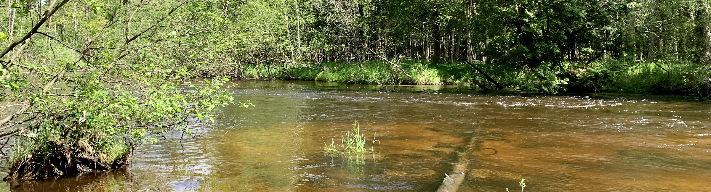
Bear Track Campground monitoring station – Our first monitoring station was put in service on the Little Manistee on April 26, 2020. It is located a mile or so upstream from Bear Track Campground and 18 Mile Bridge. The data is gathered (mostly) daily at this point from microSD cards in the monitor and manually uploaded to the internet as cell upload is not feasible at this location. We are developing radio and internet connection capabilities to take the data and upload it to the internet in real time. We hope that will happen this winter, it is a larger task than we thought. This station measures temperature in degrees centigrade and conductivity as well as the depth of the sensor below the surface of the river in mm. 25.4 mm is one inch, so 520 mm is about 20.5 inches. At the monitoring location the water is near base flow at 500 mm and very clear. Bank full at the monitoring location is about 950 mm and the water is dark.
Take a few minutes to click on the icons in the blue bands across the top of the small graphs on the web sites to get larger versions of the graphs you may find interesting. The system is still in development and can be slow to respond.
Ultimately, we plan up to five more stations to fully monitor the river along its length. The purpose of the monitoring stations is to give us a base line of data from which to track the condition of the river over time. We recognize that the Little Manistee River is in very good condition. With the monitoring stations we collect temperature, depth and conductivity data on the river multiple times a day. Over time we will build a database that shows us what the river in the current state looks like as conditions and seasons change. If in the future we see trends or large deviations from the base line develop we can recognize them and investigate causes and corrective action.
Another benefit of the monitoring station is that fishermen, kayakers and others can look at the water levels on the web and use the information to decide if the levels are in the optimal range for the activity they plan. It will take a while for everyone to learn what levels they feel are appropriate for their activities. When you visit the river its a good idea to look at the river and the water level data on the internet and consider how they correspond so over time you develop an understanding of what the levels mean.
The Mayfly Data Logger we are using was developed at the Stroud Water Research Center and was brought to our attention by Trout Unlimited as part of their project to find inexpensive ways to monitor conditions on waterways throughout the nation and the world. The computer in the Mayfly is an enhanced version of the popular Arduino computer used by hobbyists. A basic Arduino computer can be purchased for under $25. The enhanced Mayfly version with additional inputs and outputs, a real time clock and microSD card reader/writer as well as other features directed at monitoring stations is about $60. When you combine the Mayfly with a scientific grade sensor, in our case a conductivity, depth and temperature sensor you can get a monitoring station in the river for about $1500. This is about a tenth the cost of a USGS monitoring station in place on may rivers. Additional savings are achieved by using volunteers to maintain and monitor the stations. The maintenance on a USGS monitoring station we inquired about a few years ago was $17,000 annually, it does have some advanced features the Mayfly does not.
The temperature data will give us a base line on a very important characteristic for a coldwater stream. Temperature is important because colder water holds more dissolved oxygen required by the coldwater species now in the Little Manistee. Building development that removes vegetation that shades the river can cause the river to be warmed by the sun. The “hard surfaces” associated with development also cause storm water to run off directly into the river instead of being absorbed into the ground and cooled first. We estimate about 90% of the river water is from ground water sources. You can already see daily cycles in water temperature caused by the sun in our data. You can also see that when it rains and the river level rises from the additional surface runoff the water temperature also rises.
These monitors also measure the conductivity of the water in microsiemen (Also Known as Micro MHO’s) per centimeter. It gives a general idea of the dissolved solids in the water, like road salt. Distilled water has a conductivity ranging from 0.5 to 3 µS/cm, while most streams range between 50 to 1500 µS/cm. Freshwater streams ideally should have a conductivity between 150 to 500 µS/cm to support diverse aquatic life.
Last Updated: June 7, 2022 by lmwcc
Collecting data: our stream-monitoring stations
Our Little Manistee River monitoring stations are located at:
North Widewater Road (Luther) monitoring station – Our second was put in service on the Little Manistee on November 9, 2020. It is located just downstream from North Widewater Road near Luther. This station uses a cell connection to upload data every 15 minutes automatically. It uploads water depth in inches and millimeters, temperature in degrees Fahrenheit and Centigrade as well as Conductivity in microsiemen per centimeter (Also known as Micro MHO’s).
Bear Track Campground monitoring station – Our first monitoring station was put in service on the Little Manistee on April 26, 2020. It is located a mile or so upstream from Bear Track Campground and 18 Mile Bridge. The data is gathered (mostly) daily at this point from microSD cards in the monitor and manually uploaded to the internet as cell upload is not feasible at this location. We are developing radio and internet connection capabilities to take the data and upload it to the internet in real time. We hope that will happen this winter, it is a larger task than we thought. This station measures temperature in degrees centigrade and conductivity as well as the depth of the sensor below the surface of the river in mm. 25.4 mm is one inch, so 520 mm is about 20.5 inches. At the monitoring location the water is near base flow at 500 mm and very clear. Bank full at the monitoring location is about 950 mm and the water is dark.
Take a few minutes to click on the icons in the blue bands across the top of the small graphs on the web sites to get larger versions of the graphs you may find interesting. The system is still in development and can be slow to respond.
Ultimately, we plan up to five more stations to fully monitor the river along its length. The purpose of the monitoring stations is to give us a base line of data from which to track the condition of the river over time. We recognize that the Little Manistee River is in very good condition. With the monitoring stations we collect temperature, depth and conductivity data on the river multiple times a day. Over time we will build a database that shows us what the river in the current state looks like as conditions and seasons change. If in the future we see trends or large deviations from the base line develop we can recognize them and investigate causes and corrective action.
Another benefit of the monitoring station is that fishermen, kayakers and others can look at the water levels on the web and use the information to decide if the levels are in the optimal range for the activity they plan. It will take a while for everyone to learn what levels they feel are appropriate for their activities. When you visit the river its a good idea to look at the river and the water level data on the internet and consider how they correspond so over time you develop an understanding of what the levels mean.
The Mayfly Data Logger we are using was developed at the Stroud Water Research Center and was brought to our attention by Trout Unlimited as part of their project to find inexpensive ways to monitor conditions on waterways throughout the nation and the world. The computer in the Mayfly is an enhanced version of the popular Arduino computer used by hobbyists. A basic Arduino computer can be purchased for under $25. The enhanced Mayfly version with additional inputs and outputs, a real time clock and microSD card reader/writer as well as other features directed at monitoring stations is about $60. When you combine the Mayfly with a scientific grade sensor, in our case a conductivity, depth and temperature sensor you can get a monitoring station in the river for about $1500. This is about a tenth the cost of a USGS monitoring station in place on may rivers. Additional savings are achieved by using volunteers to maintain and monitor the stations. The maintenance on a USGS monitoring station we inquired about a few years ago was $17,000 annually, it does have some advanced features the Mayfly does not.
The temperature data will give us a base line on a very important characteristic for a coldwater stream. Temperature is important because colder water holds more dissolved oxygen required by the coldwater species now in the Little Manistee. Building development that removes vegetation that shades the river can cause the river to be warmed by the sun. The “hard surfaces” associated with development also cause storm water to run off directly into the river instead of being absorbed into the ground and cooled first. We estimate about 90% of the river water is from ground water sources. You can already see daily cycles in water temperature caused by the sun in our data. You can also see that when it rains and the river level rises from the additional surface runoff the water temperature also rises.
These monitors also measure the conductivity of the water in microsiemen (Also Known as Micro MHO’s) per centimeter. It gives a general idea of the dissolved solids in the water, like road salt. Distilled water has a conductivity ranging from 0.5 to 3 µS/cm, while most streams range between 50 to 1500 µS/cm. Freshwater streams ideally should have a conductivity between 150 to 500 µS/cm to support diverse aquatic life.
Category: News, Restoration Projects